Length: 14.2 km
Duration: approximately 4.30 hours
Difference in altitude +424 m / -430 m
Altitude: max. 606 / min. 315
Difficulty: E
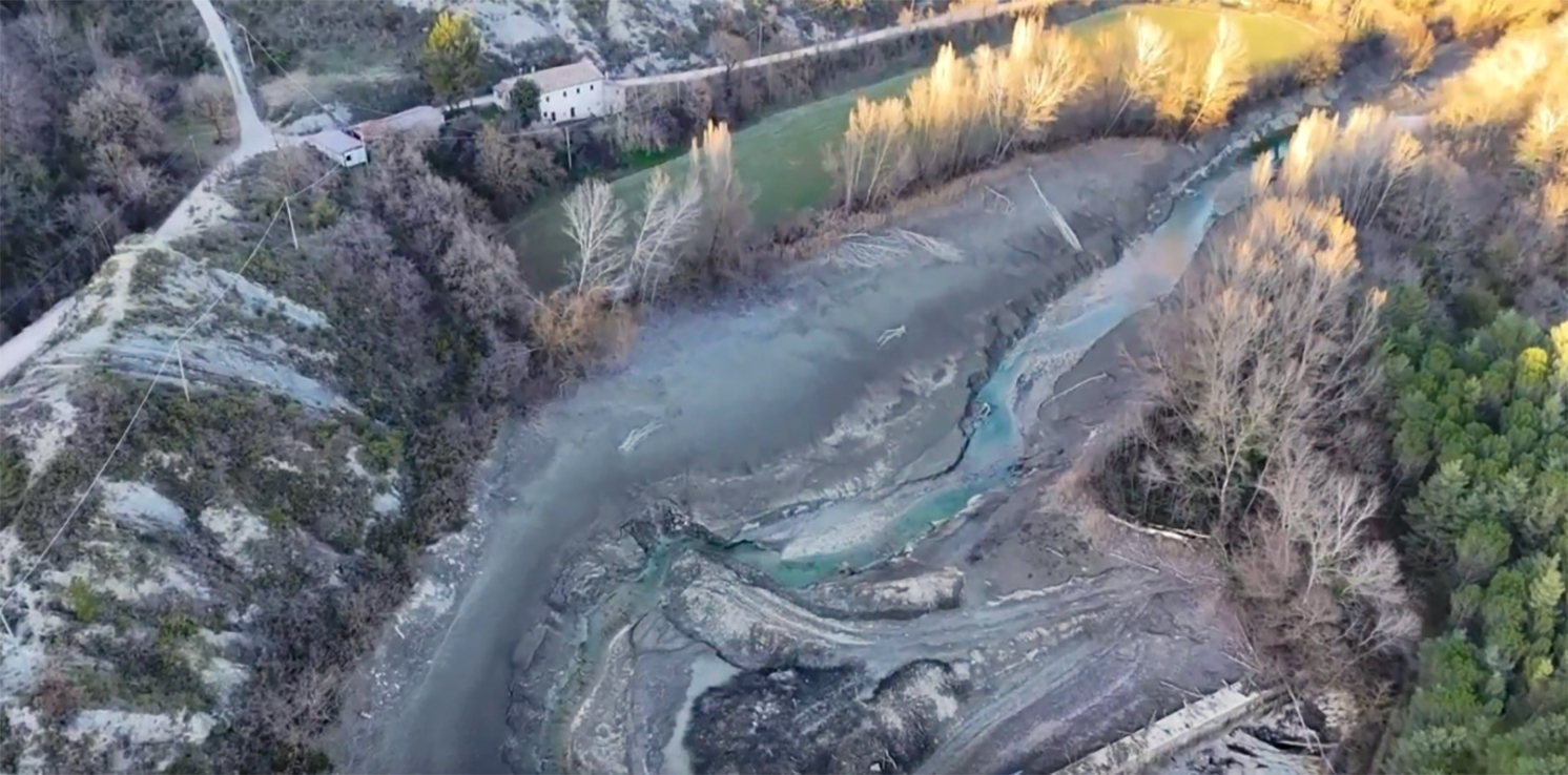
The itinerary starts from the village of Montone, from the parking lot of the panoramic square near the San Francesco museum complex, consisting of the church of the same name, the art gallery and the ethnographic museum Il Chitarra Parlante. We travel along the roads that take us to the level of the provincial road 201/2. Once at the little church, we take Viale Fortebracci, where paths 111 and 114 converge. We follow 114 in particular, which will take us to admire the Tre Ponti dam from above, a small barrier on the Carpina river built by some farmers of the Carpina Irrigation Consortium in 1951.

The stratification of marl and sandstone that catches the eye is very characteristic: you have the impression of walking in a lunar landscape, made of gullies and bright outcrops from which you can guess the powerful erosive action of the water. The area is part of the redevelopment project recently recognized by the Umbria Region known as the Ecomuseum of the Carpina Valley, a widespread museum with the declared aim of relaunching tourism and the economy of the area.
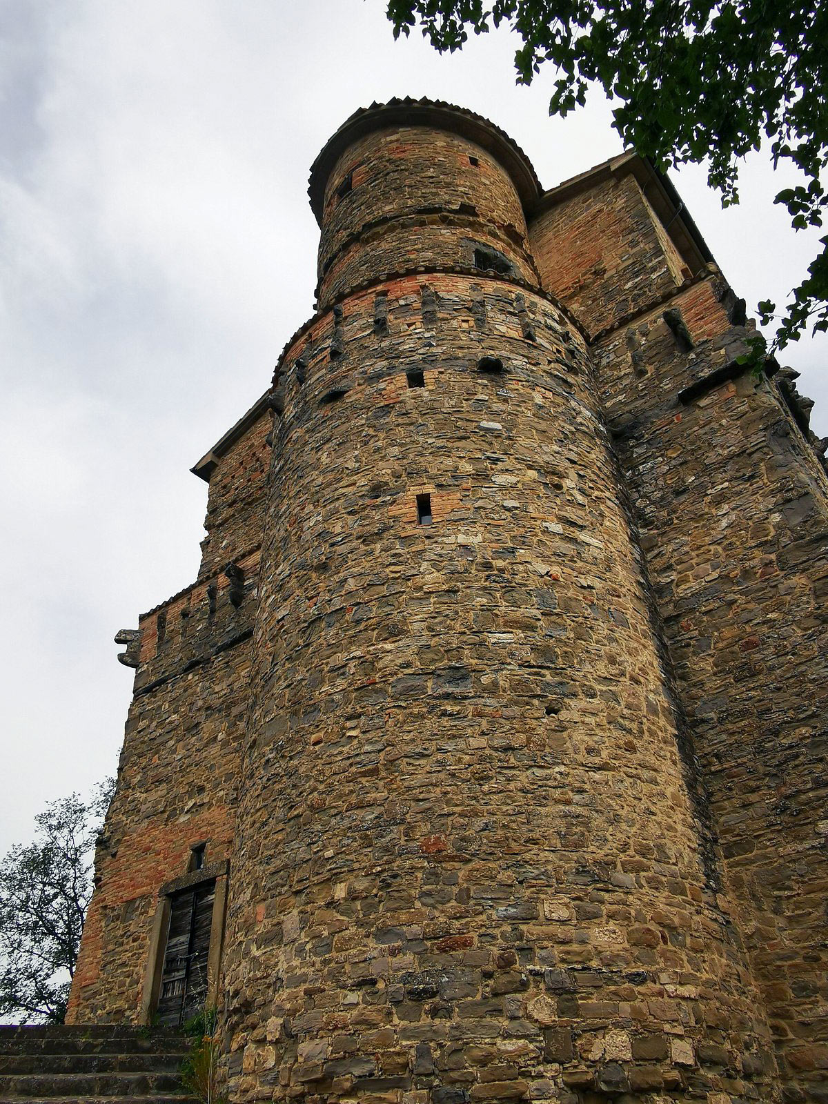
We continue halfway up the same path towards Rocca d’Aries, an ancient fortress conquered in 1376 by Oddo III Fortebracci, father of the much more famous Andrea Braccio da Montone, who was immediately commissioned by Perugia to direct the works to make it even more massive and impregnable. With its position guarding the valley of the Carpina stream and its tributary, the Sansughera stream, it allowed the control of a vast territory: therefore in the years following the conclusion of the works (which occurred in 1380), it was continually disputed between Perugia and Città di Castello. In 1381 Città di Castello managed to conquer it thanks to the aforementioned Oddo III, who in this way was exempted from paying some taxes relating to the goods he owned in the Tifernate territory. Two years later, while some castles considered of little use were dismantled, the Perugian priors provided Rocca d’Aries with an additional military contingent; the following year, this display of forces was fundamental in foiling a new attack by the Tifernate, determined to regain possession.

In the 15th century, the Rocca became a possession of Braccio Fortebracci, with whom it began to change its intended use, acquiring those residential purposes that it would retain for the following centuries, passing through the hands of the Bentivoglio family of Gubbio, the Cantamaggi and the Della Porta. When it was purchased by the Umbria Region, in the 1980s, it still belonged to this family, although it had been damaged by the 1984 earthquake.
It appears as a fortified rectangular building with a semicircular tower opposite the main facade, where the ancient portal can still be seen. The tower has a spiral staircase inside built with dry stone walls.
A curious legend was born following the great parties hosted in the fortress at the beginning of the century: it seems that unwanted guests were made to fall into a trap – a well bristling with knives – during the dance. Their blood would have dyed the waters of the Sansughera stream red, thus explaining the color that often emerged from the waters.
When we reach the crossroads, we take the first path on the left (111) and close the loop by returning towards the village of Montone.
Translation made by an automatic tool
ASD Trekkify
Latest posts by ASD Trekkify (see all)
- In the shadow of Collemancio Castle - April 24, 2025
- Suspended in the clouds: Monte Acuto - March 18, 2025
- In the shadow of the High Fortress of Dunarobba - February 25, 2025


