
Length: 9.6 km
Duration: approximately 3 hours
Difference in altitude +267 m / -271 m
Altitude: max. 384 / min. 260
Difficulty: T
The trek starts from the parking lot on Via Nocicchia, located east of the town and just outside the city walls. We follow the road – which is part of the first stage of the Cammino della Luce, a thematic itinerary that follows the route of the Via Amerina – for about fifty meters, then take the secondary road in front of us, which coincides with both the Via Amerina and the Cammino di Germanico, a ring of about 70 km that connects Amelia with its hamlets.
This path – of which we will follow stage 8 up to the Rio Grande basin, crossing stage 1 at that point – passes through areas of great naturalistic and landscape interest, winding through woods, fields and glimpses of the hamlets that, like faithful standard-bearers, surround Amelia: Santa Maria, Foce, Capitone and Sambucetole. The entire route – which owes its name to the magnificent statue of Drusus Germanicus preserved in the archaeological museum – is marked by blue signs, alternating or combined with the traditional red and white signs.
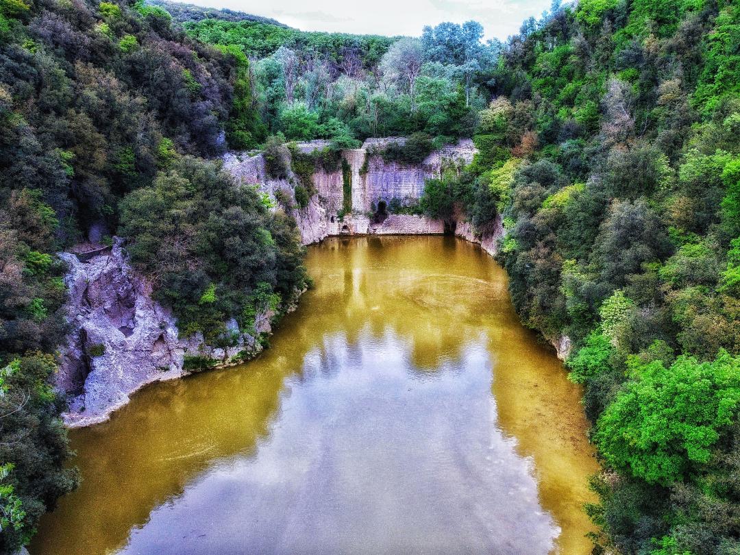
Before closing the loop we enter the Rio Grande River Park, a tributary stream of the Tiber. At the entrance to the Park we can admire two dams, one upstream and one downstream: the first, called the Para dam, is one of the oldest arch dams after the fall of the Roman Empire even if it has undergone various reconstructions, the first in the thirteenth century. It gave rise to Lago Vecchio, fed by torrential waters coming from Montecastrilli and Avigliano, which allowed the milling of wheat and olives through five structures downstream, abandoned only after the Second World War.
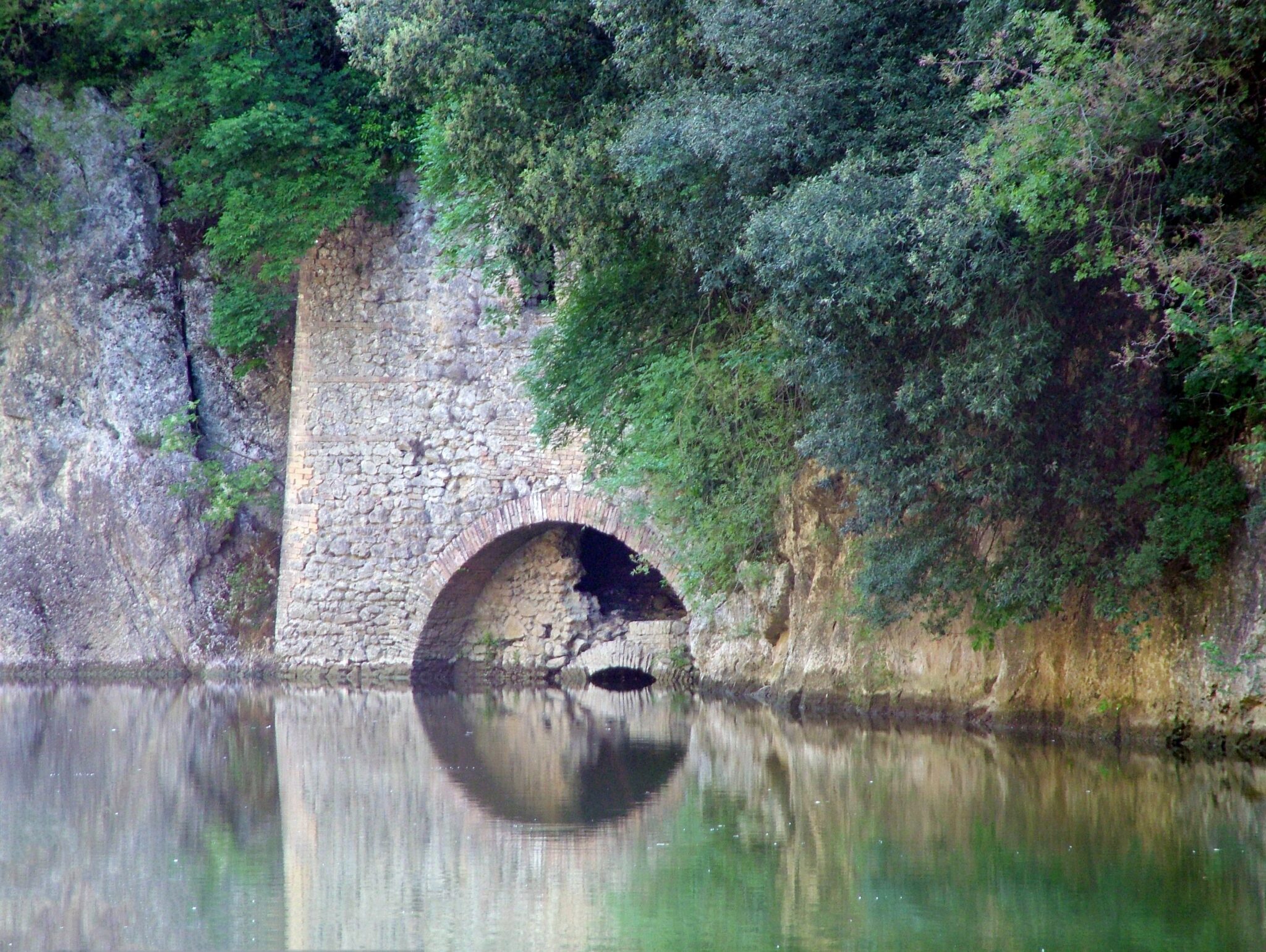
The second dam, called the Finestroni or Ponte Grande, is located a little further on and is now crossed by the SS 205 that connects Amelia to Orvieto: the medieval hydraulic structures have been juxtaposed with a bridge designed in 1880 and partially rebuilt after a bombing during the Second World War. This too is unique, as it could be one of the very few surviving Roman dams – as demonstrated by the study of the materials still visible at the base, dating back to the empire of Aurelian (270-275 AD).
The two basins – which are suffering from progressive and inexorable silting – in the past guaranteed Amelia a constant water reserve. While more in-depth interventions would be needed for them, the same cannot be said for the entire area of the River Park, which has not only been equipped with an illuminated pedestrian path and enriched with sports equipment, but has also been the scene of the Ancient Fruits project promoted by the Friends of the Rio Grande Association, aimed at recovering native tree species and marketing their derivatives.
Leaving the Para dam, we skirt the so-called Collinetta del Parco Fluviale and follow, in fact, the curve of the river, reaching the public fountain at the Para Waterfall. We go back to the barrier and turn left, crossing the Rio Grande and retracing the initial part of the path to the parking lot.
ASD Trekkify
Latest posts by ASD Trekkify (see all)
- In the shadow of Collemancio Castle - April 24, 2025
- Suspended in the clouds: Monte Acuto - March 18, 2025
- In the shadow of the High Fortress of Dunarobba - February 25, 2025

