
Length: 9.3 km
Duration: approximately 4.30 hours
Difference in altitude +652 m / – 655 m
Difficulty: E
The route starts from the dirt road that opens onto the provincial road 142/1 of Castel Rigone. After leaving the cars, you go up along a dirt road in the woods that, in a short time, will lead you to the castelliere or circle of Monte Acuto. The castellieri – very common in Umbria, the most famous is undoubtedly that of Monte Orve, in Colfiorito, protected by the FAI – were protohistoric structures that served to keep the surrounding territory under control: it is not surprising that they are found in elevated places and with views that span almost 360°. This one of Monte Acuto is no different: although the day presents a thick sea of fog, the spur on which it developed gives the idea of an extremely panoramic and strategic point for the control of the valley. It’s a shame that the panels with the historical information are now very damaged and therefore illegible.
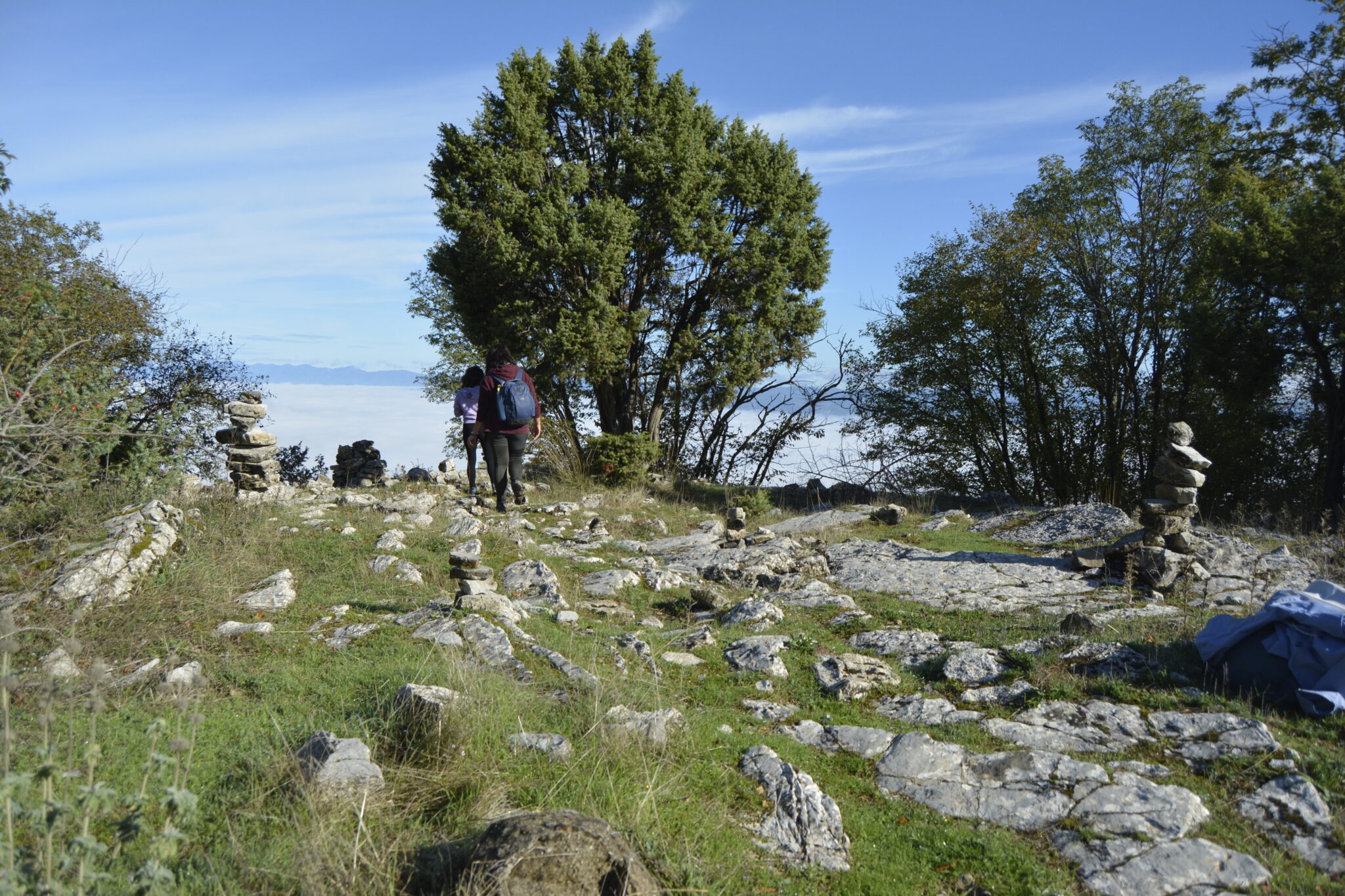
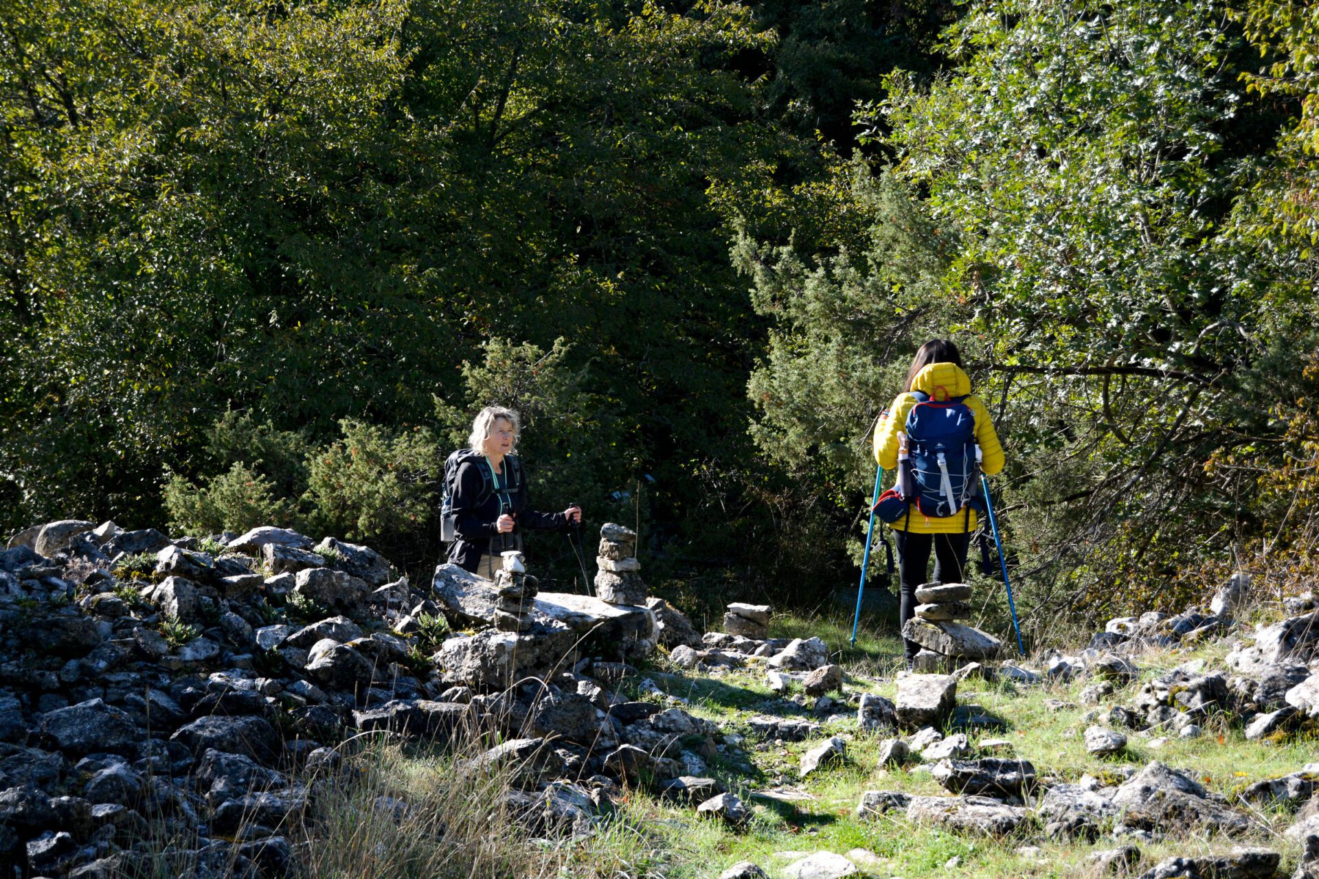
We continue the climb towards the top of Monte Acuto and, soon, the forest gives way to a path dotted with whitish rocks that climbs up the side of the mountain. In front of us we can glimpse the cone of Monte Tezio, the other Mesozoic massif in this part of Umbria, whose profile seems like a projection of the mountain we are ascending.
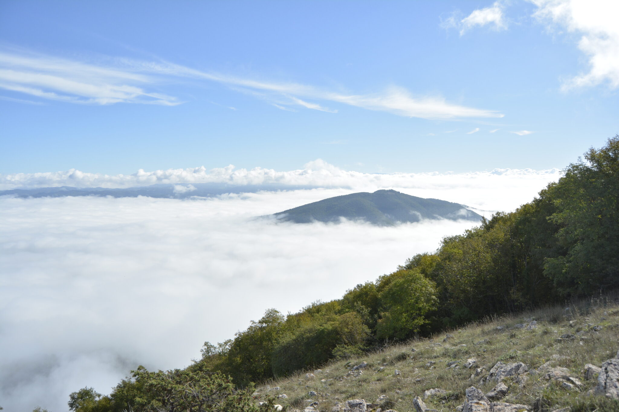
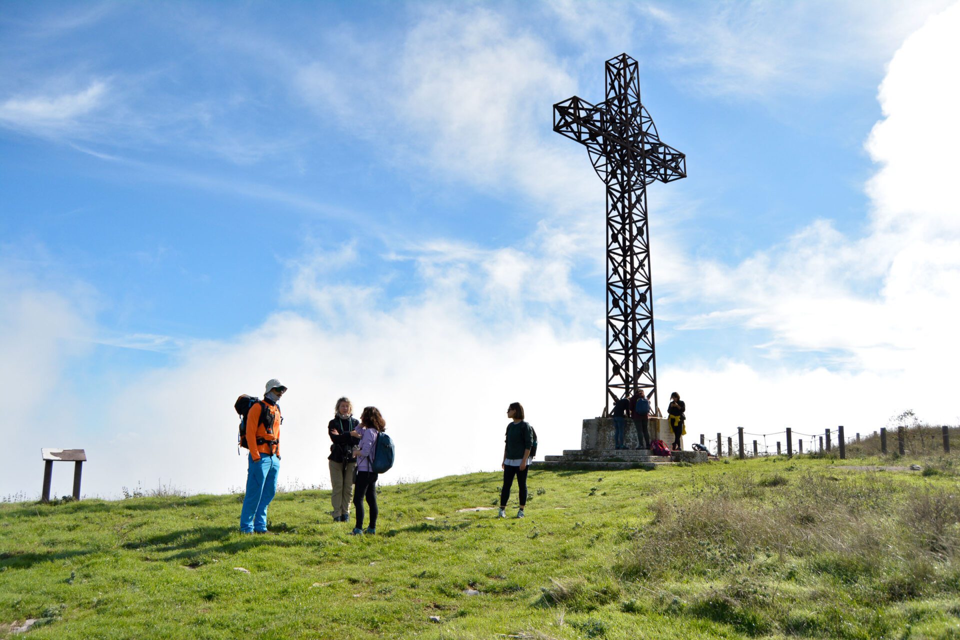
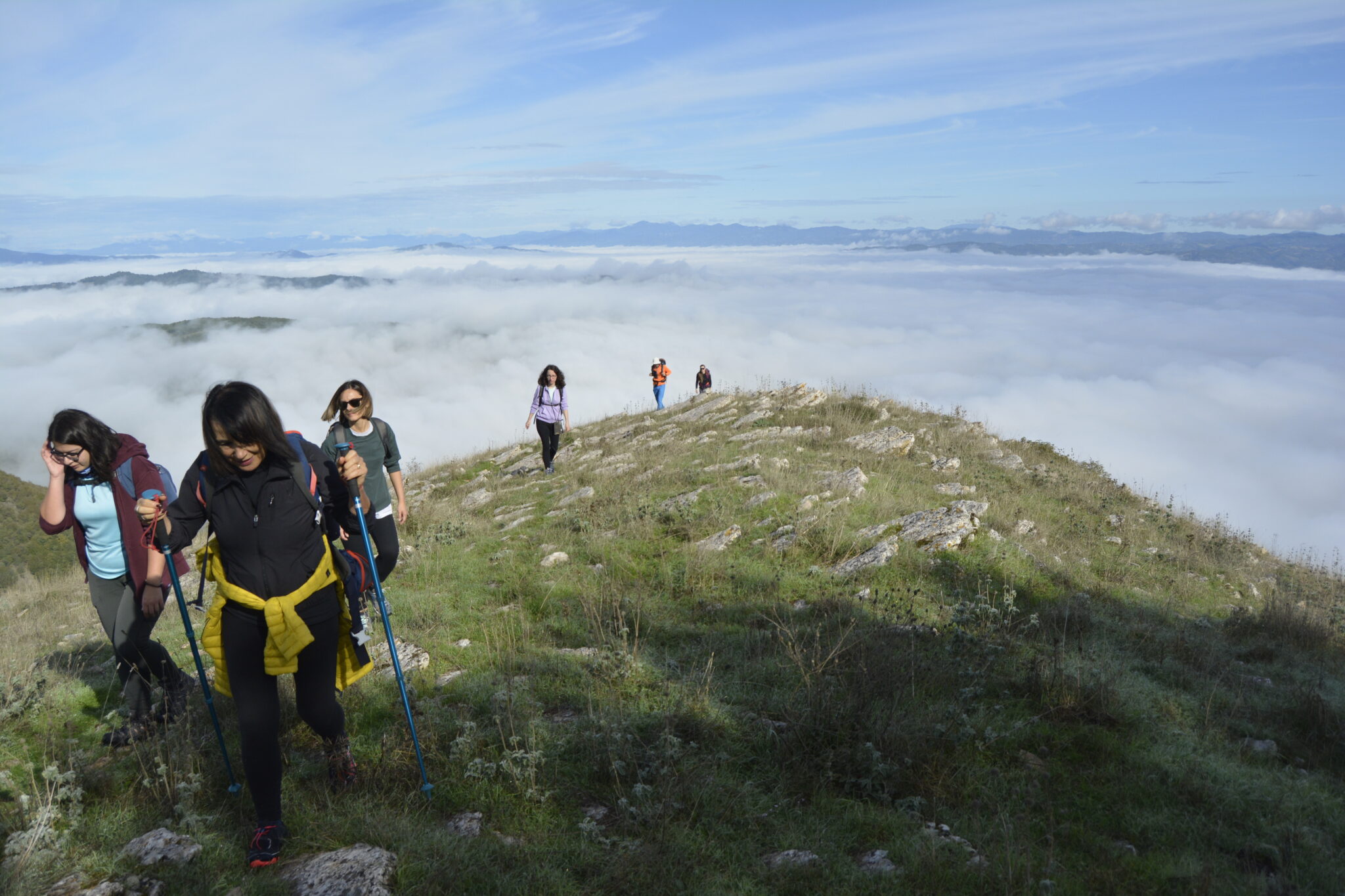
The sea of fog seems to separate us from human things, to bring us closer to celestial ones. Our ancestors must have thought so too, who, on the top of the mountain now dominated by a cross, had founded a sanctuary. It seems the votive bronzes with the features of humans and animals found during the excavation operations were intended for a deity protecting agricultural and pastoral deities. We descend from the southern slope via a mule track and close the ring by returning from the western slope, making a small detour towards the Calamanna waterfall.
ASD Trekkify
Latest posts by ASD Trekkify (see all)
- In the shadow of Collemancio Castle - April 24, 2025
- Suspended in the clouds: Monte Acuto - March 18, 2025
- In the shadow of the High Fortress of Dunarobba - February 25, 2025


